Overview

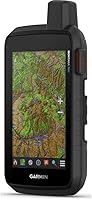
The Garmin Montana 750i Rugged GPS Handheld sits at the top of Garmin's outdoor navigation lineup, and you can tell within the first few minutes of handling it. The 5-inch touchscreen is noticeably bigger than what older Montana owners are used to, and it actually responds well even when you're wearing thick gloves in cold weather. What really separates this from a typical trail GPS is the built-in inReach messaging — most handheld units stop at mapping and tracking, but this one lets you reach help when there's no cell signal at all. Given the price tag, it's clearly built for people who venture far from paved roads, not weekend park walkers. Mapping, photography, and emergency communication are packed into one rugged shell, which is rare to find done well.
Features & Benefits

Out on the trail, this handheld GPS unit earns its keep through a handful of features that work together rather than feeling bolted on. The Iridium-based two-way messaging means you can send an SOS or just check in with family from places where your phone is useless. Multi-GNSS support, pulling from both GPS and Galileo satellites, keeps your position locked in even under heavy tree cover or canyon walls. Maps are preloaded — TopoActive and Navigator — so you're not stuck buying extra cartography before a trip. The camera won't replace your phone, but it's handy for quickly logging a landmark or trail condition. Add Wi-Fi, Bluetooth, and ANT+ for syncing with apps and downloading BirdsEye imagery, plus a battery that comfortably lasts a full day of hard use, and the package feels genuinely complete.

Best For

The Montana 750i makes the most sense for people who actually leave reliable cell coverage behind — backcountry hikers, hunters, and anyone spending days at a time in remote terrain. Overlanders and truck travelers benefit too, since it blends routable road maps with off-road topo data in one device, useful when a route crosses both pavement and trail. Search-and-rescue volunteers and remote workers who need a dependable way to call for help will appreciate the SOS function specifically. It's also a natural upgrade for longtime owners of older Montana units who've been waiting for a bigger, more responsive screen. That said, if you're just doing casual day hikes near town with full signal the whole time, this is more capability than you'll likely use, and a simpler GPS would serve just as well.

User Feedback

Real-world owners tend to echo a lot of the same points once they've put a few months on this satellite communicator. The bigger screen gets singled out often, with several buyers noting that it stays responsive even with gloves or wet fingers, which matters more than it sounds out in bad weather. Route planning through the companion app also draws steady praise, especially from people who plan trips at home before heading out. On the downside, a few first-time buyers admit there's a real learning curve to the satellite messaging setup, and the ongoing subscription cost catches some people off guard after the initial purchase. Build quality is where almost everyone agrees, though — reviewers consistently describe it as something that can take a drop, a downpour, or a rough pack without complaint.

Pros

  • Two-way satellite messaging provides real peace of mind far from cell coverage
  • Touchscreen stays responsive even with gloves on in cold or wet conditions
  • Multi-GNSS support holds a steady location lock under heavy tree cover
  • Preloaded topo and road maps mean no extra map purchases needed upfront
  • Battery comfortably handles a full day of heavy use in the field
  • Garmin Montana 750i Rugged GPS Handheld combines navigation, camera, and SOS in one device
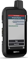
  • Build quality consistently described as tough enough for drops and rough weather
  • Route planning through the companion app is straightforward for trip prep at home

Cons

  • Satellite messaging setup has a real learning curve for first-time users
  • Ongoing subscription cost adds to the total price beyond the initial purchase
  • Overkill for casual hikers who never leave reliable cell phone coverage
  • Camera quality is basic and shouldn't be the reason you buy this device
  • Larger screen and rugged housing add noticeable bulk compared to simpler GPS units
  • Price point puts it out of reach for buyers wanting an occasional-use gadget
  • Some features require pairing with apps, which adds setup steps before first use

Ratings

These scores for the Garmin Montana 750i Rugged GPS Handheld were generated by AI after analyzing verified user reviews from outdoor retailers and forums worldwide, with spam, bot activity, and incentivized feedback filtered out. The goal is to give you an honest picture of where this satellite communicator genuinely excels and where real owners have run into friction.
Build Quality & Durability
91%
Owners consistently describe the housing as genuinely rugged, surviving drops on rocky trails and repeated exposure to rain without issue. The military-grade construction feels like more than a marketing label once you've actually carried it through a few seasons of hard use in unpredictable weather.
A few buyers note the device feels noticeably bulkier and heavier than typical hiking GPS units, which can matter on long backpacking trips where every ounce counts. It's not a dealbreaker, but it's a tradeoff for the rugged shell.
Display & Touchscreen Usability
88%
The 5-inch glove-friendly screen is one of the most praised upgrades, with users specifically calling out how well it responds in cold weather without needing to remove gloves. Compared to older Montana models, the size jump makes route reading and menu navigation noticeably easier.
Direct sunlight can still wash out visibility on the brightest days, requiring users to angle or shade the screen. A handful of reviewers also mention occasional touch lag when wearing thicker winter gloves.
Satellite Communication (inReach SOS)
93%
This is the standout feature for most buyers, offering genuine peace of mind through two-way Iridium messaging when hiking or hunting far from cell towers. Search-and-rescue volunteers and remote workers especially value having a dependable SOS option built directly into their navigation device.
First-time users report a real learning curve getting comfortable with the messaging interface and emergency trigger before heading into the field. Message delivery can also lag a few minutes depending on satellite positioning and terrain.
GPS Accuracy & Signal Lock
86%
Multi-GNSS support pulling from both GPS and Galileo satellites earns solid praise for holding a steady lock under tree cover and in canyon terrain where older single-system units often struggle. Overlanders mention smoother route tracking on mixed road-and-trail trips.
Some users in extremely dense forest or deep valley terrain still report brief signal gaps. It's a meaningful improvement over older models, but not flawless in the most challenging environments.
Battery Life
84%
The rated 18-hour battery life holds up well for a full day of heavy GPS tracking and screen use, which reviewers say comfortably covers most single-day excursions without anxiety about running dry.
Heavy camera and satellite messaging use noticeably shortens runtime, and multi-day trips still require a backup power bank or solar charger according to several long-distance hikers.
Mapping & Navigation Features
89%
Preloaded TopoActive and City Navigator maps save buyers from extra purchases right out of the box, and the combination of off-road topo data with routable road maps gets specific praise from overlanders planning mixed-terrain trips.
A few reviewers wish certain regional map packs were included by default rather than requiring separate downloads through BirdsEye imagery for more detailed satellite views.
Camera Quality
61%
39%
The 8-megapixel camera is convenient for quickly snapping a trail marker, landmark, or condition report without pulling out a phone, which several users find genuinely useful for trip documentation.
Image quality falls noticeably short of even mid-range smartphone cameras, and most owners say they wouldn't rely on it for anything beyond basic reference photos.
Wireless Connectivity & App Integration
78%
22%
Wi-Fi, Bluetooth, and ANT+ connectivity make syncing with the Garmin Explore app straightforward, letting users plan routes at home and review trip data afterward without manual file transfers.
Initial pairing and firmware updates can be slower than expected, and a small number of users report occasional Bluetooth dropouts when connecting to phones mid-trip.
Ease of Use & Learning Curve
68%
32%
Once configured, day-to-day navigation and route following feel intuitive, especially for anyone who has used a Garmin device before and is already familiar with the general menu layout.
New owners frequently mention needing real practice time to get comfortable with satellite messaging setup and the deeper menu structure before trusting it in an actual emergency situation.
Portability & Ergonomics
72%
28%
The grip and button placement get decent marks for one-handed operation on the trail, and the weight feels reasonable for the amount of technology packed inside the unit.
Compared to smaller handheld GPS units, this one is bulkier in a pocket or pack, and a few reviewers wish it came with a more streamlined mounting option.
Value for Money
76%
24%
For serious backcountry users, hunters, and overlanders, the combination of satellite SOS, dual-GNSS accuracy, and preloaded mapping justifies the upfront cost as a long-term investment in safety and capability.
Casual hikers who rarely leave cell coverage often feel the price is hard to justify, and the ongoing subscription requirement adds a recurring cost many buyers don't fully anticipate.
Ongoing Subscription Cost
58%
42%
Buyers who use the satellite features regularly generally feel the subscription is a fair tradeoff for reliable emergency communication, especially compared to carrying a separate standalone satellite messenger.
Several reviewers express frustration that the total cost of ownership isn't obvious at purchase, and infrequent users feel like they're paying for a plan they barely use month to month.

Suitable for:

The Garmin Montana 750i Rugged GPS Handheld is built for people whose adventures regularly take them past the last cell tower. Backcountry hikers and hunters who spend multiple days at a stretch in remote terrain will get real use out of the satellite messaging, since it offers a way to call for help when nothing else works. Overlanders and off-road truck travelers are another strong fit, especially given the mix of routable road maps and topo data that lets you plan a route crossing both pavement and trail. Search-and-rescue volunteers and remote workers who need a dependable check-in method will also find the SOS function genuinely useful rather than just a nice-to-have. Owners of older Montana models looking for a bigger, more responsive screen will likely consider this a worthwhile step up too.
Not suitable for:

This isn't the right pick for casual day hikers who stay within cell coverage and just want a basic way to follow a marked trail. The Garmin Montana 750i Rugged GPS Handheld carries a price that's hard to justify if you don't actually need satellite messaging or multi-day battery life. Anyone uncomfortable with a learning curve should also pause, since setting up the satellite communicator features takes more effort than a typical consumer GPS app. Buyers who forget to factor in the ongoing subscription cost often feel blindsided by the total expense down the line. If your outdoor trips rarely go beyond a few hours near town, a phone app or a far simpler handheld will cover your needs without the added complexity or cost.
Specifications

  • Display: The screen measures 5 inches with a resolution of 480 x 800 pixels and supports touchscreen input even while wearing gloves.
  • Satellite Communication: Built-in inReach technology connects to the 100% global Iridium satellite network for two-way messaging and SOS alerts.
  • GNSS Support: The unit supports multi-GNSS positioning using both GPS and Galileo satellite systems for improved accuracy.
  • Navigation Sensors: A 3-axis compass and barometric altimeter are included for orientation and elevation tracking.
  • Preloaded Maps: TopoActive and City Navigator maps for North America come preloaded on the device.
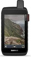
  • Camera: An 8-megapixel camera is built in for capturing trail and landmark photos on the go.
  • Wireless Connectivity: The device offers Wi-Fi, Bluetooth, and ANT+ connectivity for app pairing, imagery downloads, and location sharing.
  • Battery Life: A rechargeable lithium-ion battery pack provides up to 18 hours of use per charge.
  • Dimensions: The handheld unit measures 7.2 x 3.6 x 1.3 inches.
  • Weight: The device weighs 1.55 pounds including the battery pack.
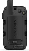
  • Build Type: The housing uses military-grade rugged construction designed to withstand outdoor field conditions.
  • App Compatibility: The device pairs with the Garmin Explore app and website for managing waypoints, routes, and trip data.
  • Connectivity Technology: ANT+ wireless technology is supported for connecting compatible accessories and sensors.
  • Included Components: The package includes the Montana 750i unit, a lithium-ion battery pack, a USB cable, and documentation.
  • Subscription Requirement: An active satellite subscription plan is required to use the inReach messaging and SOS features.
  • Operating System: The device runs on a proprietary Garmin operating system designed specifically for handheld navigation units.

Related Reviews

Garmin GPS 73
Garmin GPS 73
80%
93%
Battery Life
88%
SailAssist Features
91%
Build Quality & Durability
54%
Display Quality
82%
Ease of Use
More
Garmin GPSMAP 86Sci Handheld GPS
87%
92%
Durability & Build Quality
88%
Display Quality
85%
Battery Life
90%
Ease of Use
93%
Water Resistance & Floating Design
More
Garmin GPSMAP 65s Handheld GPS
80%
93%
GPS Accuracy
88%
Battery Performance
91%
Build Quality
74%
Display Readability
89%
Satellite Lock Speed
More
Garmin GPSMAP 64sc Handheld GPS
78%
93%
GPS & Satellite Accuracy
89%
Battery Life & Flexibility
91%
Build Quality & Durability
58%
Built-in Camera & Geotagging
82%
Display Readability
More
Garmin eTrex Touch 25 Handheld GPS
79%
91%
GPS Accuracy
88%
Battery Performance
84%
Build Quality
71%
Touchscreen Usability
58%
Map Detail
More
Garmin eTrex 30x Handheld GPS Navigator
87%
89%
Build Quality & Durability
86%
Battery Life
86%
Battery Life Cons
More
Garmin eTrex Solar Handheld GPS Navigator
80%
91%
Battery Life
88%
GPS Accuracy
93%
Build Quality
58%
Display Quality
67%
Solar Performance
More
Garmin eTrex 32x Handheld GPS Navigator
78%
93%
Satellite Performance
91%
Battery Life
88%
Build & Durability
74%
Map Quality & Coverage
89%
Navigation Accuracy
More
Garmin eTrex SE Handheld GPS Navigator
81%
97%
Battery Life
91%
GPS Accuracy
88%
Build Quality
63%
Display Quality
79%
Ease of Use
More
Garmin GPSMAP 79s Marine Handheld GPS
78%
93%
GPS Accuracy
91%
Floatation Design
74%
Battery Life
78%
Water Resistance
63%
Display Quality
More

FAQ

Yes, the inReach satellite functions require an active satellite subscription plan through Garmin, which is separate from the device purchase itself. Without an active plan, two-way messaging and SOS won't work, so it's worth factoring that ongoing cost into your budget before buying.

Yes, this is one of the more consistently praised features among real owners. The 5-inch screen is specifically designed to register input through gloves, which matters a lot in cold or wet conditions where you don't want to be removing them constantly.

Garmin rates it at up to 18 hours per charge, which generally holds up for a solid day of heavy use including GPS tracking and screen time. For multi-day trips you'll still want a backup power source or solar charger, especially if you're using the camera and satellite features frequently.

Yes, that's actually one of its strengths. This handheld GPS unit comes preloaded with both routable road maps and topo data, so you can plan a route that crosses pavement and backcountry trail without needing separate devices or map purchases.

There is, honestly. Setting up the inReach messaging and getting comfortable with the menus takes more time than a typical phone GPS app. Most buyers say it's worth spending an afternoon at home practicing before relying on it in the field.

Because it supports multi-GNSS positioning using both GPS and Galileo satellites, it tends to hold a lock better than single-system units in challenging terrain like heavy tree cover or canyon walls. It's not flawless everywhere, but it's noticeably more reliable than older single-GNSS handhelds.

Not really, and it's not meant to. The 8-megapixel camera is handy for quickly documenting a landmark, trail condition, or waypoint, but it shouldn't be your primary camera if photo quality is a priority.

The Garmin Montana 750i Rugged GPS Handheld ships with the unit itself, a lithium-ion battery pack, a USB charging cable, and basic documentation. You won't need to buy a separate battery to get started.
Yes, the device pairs with the Garmin Explore website and app, which lets you build waypoints, routes, and collections at home before syncing them over to the unit. It also lets you review trip data afterward, which is handy for keeping a record of past adventures.

Honestly, probably. If you're staying within cell coverage and doing short day hikes, the satellite messaging and rugged build aren't features you'll get much use out of. This is really built for people heading well beyond reliable signal for extended stretches.